Notches and mushrooms
Numerous indicators of uplift other than uplifted corals (e.g. Fig1) are preserved in limestones in the epicentral region of the Haiti 12 January earthquake.

Fig 1. Brain Dead Coral - a brain coral raised above its survival level. The central discolored region is dead and algae are growing on its lower half.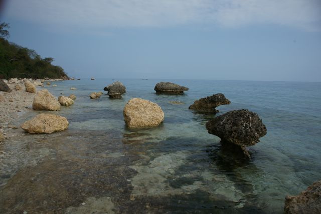
Fig. 2. A cluster of limestone blocks (yellow) tumbled in an earthquake triggered landslide 12 January, with similar-sized blocks (black) with deep notches presumably tumbled in former earthquakes or during monsoon triggered slides.
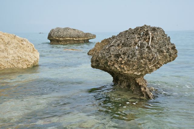
Fig. 3 Close up view of two mushroom-dissolved blocks. The stability of these blocks is attributed to the fact that they rest on an eroded carbonate terrace that extends like an apron 20-50 m offshore.
Sea Level Histogram
Tide gauges in the region installed after the earthquake record the range of intertidal sea level including the effects of fetch, sea currents etc. Fig. 4 illustrates two weeks of sea level data and the histogram of sea level at Gonave, 20 km to the north of the above mushroom rocks.
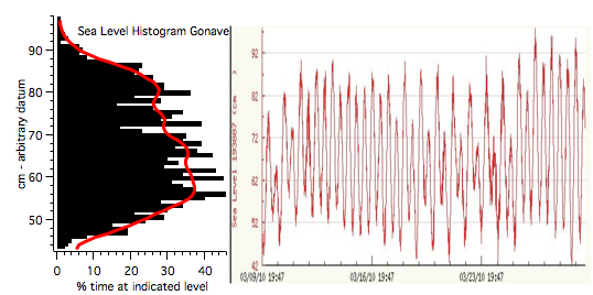
Fig.4 Two weeks of sea level data from Gonave Island (right) and the computed and smoothed histogram derived from these data (left).
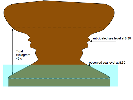
Fig. 5. Theoretical profile of a mushroom-shaped rock formed by projecting a mirror image of the sea level histogram onto a cylindrical block. The difference between observed and theoretical sea level indicates uplift of 10-20 cm in the January earthquake.
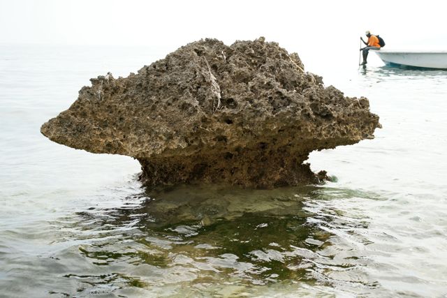
Fig. 6. An isolated mushroom coral that has the potential to provide precise estimates of uplift in the recent earthquake.
Coseismic uplift
Knowing the instantaneous tidal stage, and its anticipated pre-uplift relation to the tidal histogram, we estimate local uplift on 12 January to have been 10-20 cm (Fig.5 & 6). More precise measurements of instantaneous local sea level suggest uplift estimates could be improved by an order of magnitude.
In some locations there is clear evidence for a parallel notch approximately 40 cm above the recently uplift notch illustrating that this is not the first time that uplift has occurred at this location, and that previous uplifts were twice as much as in 2010. In some of these blocks the notches are not parallel (Fig. 7) suggesting abrupt tilt has been caused by collisions from blocks falling in subsequent earthquakes, or by rainfall-triggered landslides.
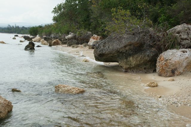
Fig. 7 Tilted block with two previous sea level notches inclined to horizontal, the lowest of which has been raised above current sea level by at least 50 cm.